Showing posts with label Wakefield Covered Bridge. Show all posts

Saturday, June 16, 2018

Bridge And River

The Wakefield Covered Bridge is fascinating to walk through, open to the breezes coming off the river. This view from within looks downstream.


Looking around gives a view of the structure itself- truly a labour of love for the community.


Here we have another view looking upstream, this time at the west end of the bridge.


And here we've got the west entrance. There are doorways on each end (so the bridge is likely closed up overnight), and landscaping done, along with the plaque and the historical signs. When the bridge was inaugurated in 1998 by Romeo LeBlanc, the Governor General at the time, it was welcomed by the community and beyond, a special place for a village that is special in and of itself.


I started back, photographing the east shore. 


Then I paused to photograph downstream again. Though Wakefield lies outside the boundaries of Gatineau Park, the terrain here is very much typical of the Gatineau Hills themselves.


Weddings are held from time to time on the bridge. This photograph was included in one of the display panels.


We took our leave of the bridge, pausing down the road to take in one final view of it from upstream. This ends my series from the Gatineau Hills. I hope you have enjoyed the tour.

Friday, June 15, 2018

Wakefield Bridge

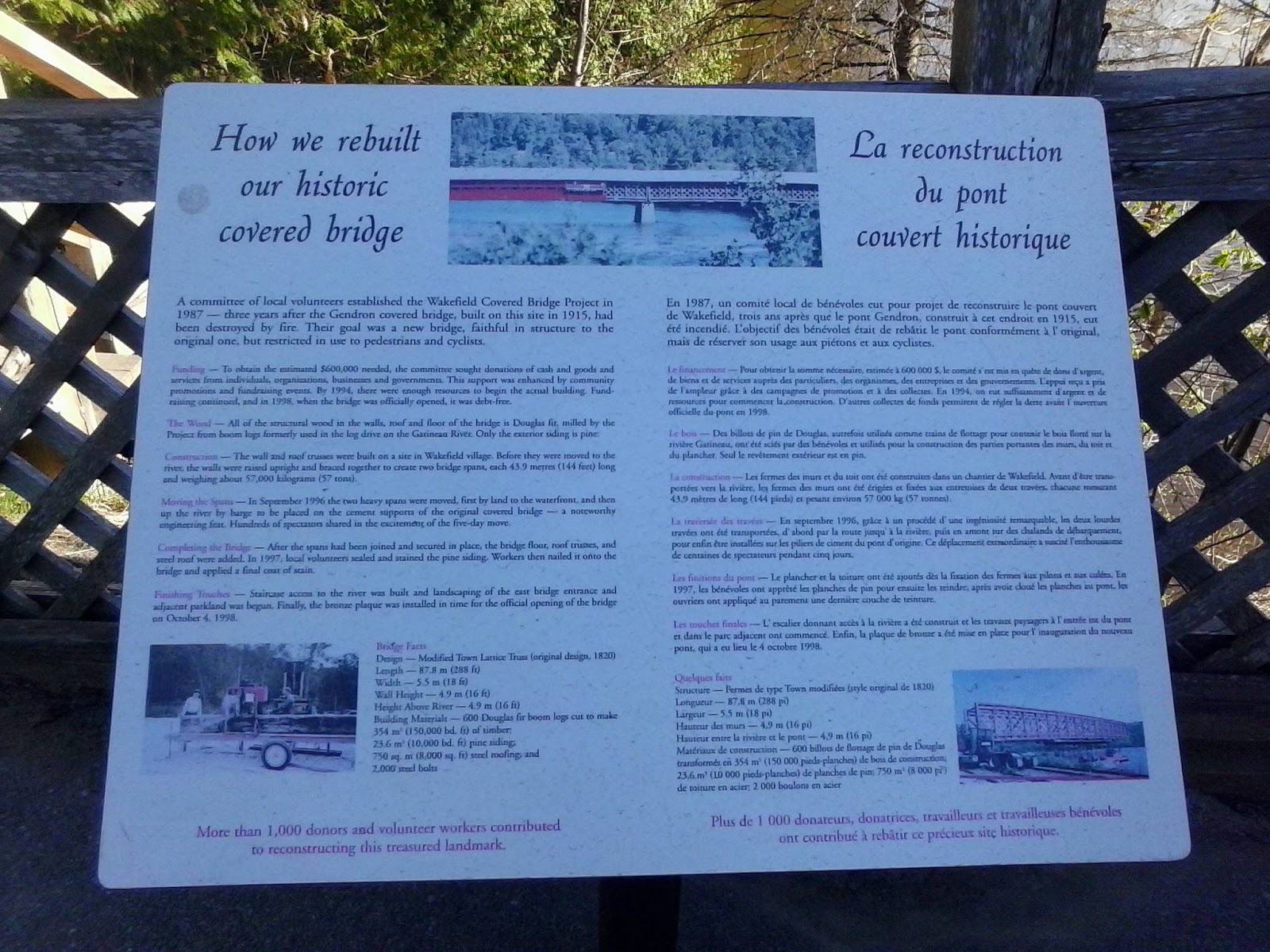
One last spot in this excursion into the Gatineau Hills was a bridge spanning the Gatineau River at Wakefield. Given Tom's interest in covered bridges, I knew he and Janette would enjoy this one. The Wakefield Covered Bridge is seen here from the auto bridge upstream. The first bridge, the Gendron, built in 1915, was destroyed by fire in the 1980s. It was a blow to the community, who organized to rebuild it, and the finished bridge was inaugurated in 1998. It is open to pedestrians and cyclists, but not to cars. The bridge is faithful in design to its predecessor, and rests on top of the original cement supports.


Here we have the entrance on the east side. The bridge is 87.8 metres (288 feet) long, 5.5 metres (18 feet) wide, and both 4.9 metres (16 feet) above the river and in terms of its wall height. Most of that's wood- Douglas fir for the structure and pine exterior siding, with a steel roof.


A nearby staircase leads down to the river itself.


This view looks downstream. The better part of the village is down there at a bend in the river.


Here we have a view looking back up.


A sign with the vital statistics of the structure and the story of its new life is found near the entrance. The old bridge was very much the heart of the community, and its destruction was a profound loss. Resurrecting it in a new bridge has given the community its heart back.


Before stepping inside, I paused to photograph upstream. The bridge we crossed over with the car is over there.


Inside the bridge, there are displays about the history of the old bridge and the building of the new one. The community came together to raise the funds- $600 000- to rebuild, and the two spans of equal length were first assembled on land and then floated on the river by barge to the site. Those spans weighed 57 000 kilograms. I have more from here in tomorrow's post.