Showing posts with label Gatineau River. Show all posts

Saturday, June 6, 2020

The Roaring Of The Waterfalls

Continuing where I left off yesterday, here's another view of the east branch of the Rideau Falls. Note the snow down below, yet to melt in spring conditions at the time I took these shots in early April.


Here we have a first glimpse of the west branch of the falls. The National Research Council has its facilities on the far shore.


I started across the bridge spanning the west branch.


I reached the viewing area on the west shore. In the distance on the Gatineau side of the Ottawa River, a number of buildings can be glimpsed. That's where the main channel of the Gatineau River merges with the Ottawa River.

Friday, June 5, 2020

A Meeting Place Of Two Rivers

One day in early April I headed out to the New Edinburgh area to visit this waterfall. The Rideau Falls are where the Rideau River ends, pouring into the Ottawa River east of the downtown in two plunge falls, separated by Green Island. On this shore, the New Edinburgh side, the east falls were filled with spring run off. The falls were sighted by Champlain when he first came up the Ottawa River in 1613; Rideau means curtain in French. From time immemorial before that, First Nations tribes lived and journeyed through this area, and they were already familiar with this place.


In the background are a couple of buildings, both for the foreign ministry. The Diefenbaker Building, at left, stands on Green Island. Beyond it on the west shore of the Rideau River is the Pearson Building. And the National Research Council has labs facing the Pearson Building, seen at right in the background.


A look across the Ottawa River takes in the Gatineau shoreline. That wooded area is parkland, the Leamy Lake Park. Outlets of the Gatineau River merge with the river over there, though the main channel lies to the east.


I started along the bridge crossing over the falls.


Here we have a look at the east falls from the viewing platform on Green Island. We'll pick up from here tomorrow.

Wednesday, January 2, 2019

City Daily Photo Theme Day: Best Of The Year

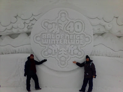
Continuing on with my favourite shots of 2018, today I'm concentrating on Gatineau and the larger area called the Outaouais- a French translation for the Ottawa River and this area along its shore in the province of Quebec. Winterlude has activities in Gatineau as well as in Ottawa in February, with Jacques Cartier Park on the shore of the Ottawa River being turned into a massive snowy playground. Snow sculptures are part of that.


In May, Tom and his wife came up to Ottawa to see the tulips, and I escorted them on tours of the area. That included an excursion into Gatineau Park, a large swath of nature beyond the city of Gatineau in the regional municipality of Les Collines-des-l'Outaouais. We stopped at this countryside church, St. Stephen's Catholic Church, in the village of Chelsea. The parish has roots that go back to 1840, with the current building dated to the 1880s.


Up in Gatineau Park itself, the Mackenzie King Estate is to be found. William Lyon Mackenzie King, one of our finest prime ministers, left this weekend retreat that had been his real home to the people of Canada in his will. This is a view of one of the houses, Moorside, taken in May.


The Gatineau River flows along the east edges of Gatineau Park towards its terminus with the Ottawa River, and here at the village of Wakefield, we find the Wakefield Covered Bridge crossing it. This view from the north gives a good view of the bridge, which was rebuilt in the 1990s after the first bridge was destroyed by fire. Today it is a pedestrian and bikes only bridge, and it is a beauty, spanning a length of 87.8 metres.


The Canadian Museum of History stands along the shore of the Ottawa River in Gatineau, another of our national museums, and I've visited several times over the year. Each visit always includes a look at the monumental abstract mural Morning Star, by the First Nations artist Alex Janvier, high over the Grand Hall. This photo includes people in the upper level, reinforcing how big the mural is. If I had to pick a favourite work of art in the National Capital Region, this would be it.


On another visit, I took in one of the temporary exhibits. Medieval Europe is soon to finish up its time here, and examines life in Europe from the end of the Roman Empire to the Renaissance. At the heart of the space are a series of screens that rotate between images of European architecture and period statues. This particular one, with visitors amid the architecture, stuck with me.


Jacques Cartier Park hosted the topiary event MosaiCanada for the second and final year, a fabulous collection of living, sculpted art. They included a mother and cub pair of foxes, much larger than life.


This one featured a shepherd, sheep dog, and sheep- the dog's expression was priceless.


One of the show stoppers was this massive tree containing a variety of birds.


And of course my favourite of all the topiaries, a First Nations inspired take on Mother Earth, surrounded by animals and looking quite peaceful.


An October visit back to the Gatineau Hills brought me back to the Mackenzie King Estate for the fall colours. King was something of an eccentric, taking bits and pieces of buildings that were demolished and incorporating them into his estate as follies. They included various pieces that make up what is today called the Abbey, which looks splendid among fall colours.


And I finish with this grand view. There are several lookout spots not far from the Estate. This one is the Champlain Lookout. Here the visitor can look out over the steep drop to the valley floor. The Ottawa River is there in the distance, winding its way upstream.

Saturday, June 16, 2018

Bridge And River

The Wakefield Covered Bridge is fascinating to walk through, open to the breezes coming off the river. This view from within looks downstream.


Looking around gives a view of the structure itself- truly a labour of love for the community.


Here we have another view looking upstream, this time at the west end of the bridge.


And here we've got the west entrance. There are doorways on each end (so the bridge is likely closed up overnight), and landscaping done, along with the plaque and the historical signs. When the bridge was inaugurated in 1998 by Romeo LeBlanc, the Governor General at the time, it was welcomed by the community and beyond, a special place for a village that is special in and of itself.


I started back, photographing the east shore. 


Then I paused to photograph downstream again. Though Wakefield lies outside the boundaries of Gatineau Park, the terrain here is very much typical of the Gatineau Hills themselves.


Weddings are held from time to time on the bridge. This photograph was included in one of the display panels.


We took our leave of the bridge, pausing down the road to take in one final view of it from upstream. This ends my series from the Gatineau Hills. I hope you have enjoyed the tour.

Friday, June 15, 2018

Wakefield Bridge

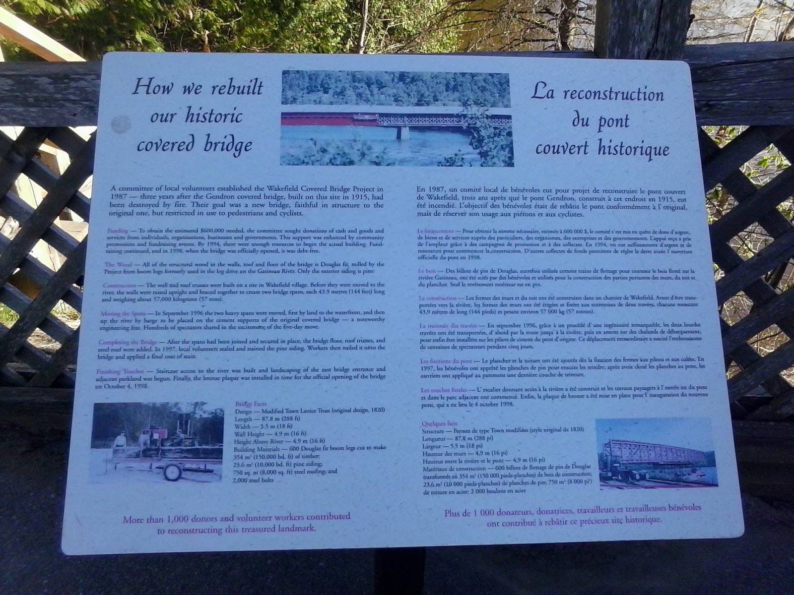
One last spot in this excursion into the Gatineau Hills was a bridge spanning the Gatineau River at Wakefield. Given Tom's interest in covered bridges, I knew he and Janette would enjoy this one. The Wakefield Covered Bridge is seen here from the auto bridge upstream. The first bridge, the Gendron, built in 1915, was destroyed by fire in the 1980s. It was a blow to the community, who organized to rebuild it, and the finished bridge was inaugurated in 1998. It is open to pedestrians and cyclists, but not to cars. The bridge is faithful in design to its predecessor, and rests on top of the original cement supports.


Here we have the entrance on the east side. The bridge is 87.8 metres (288 feet) long, 5.5 metres (18 feet) wide, and both 4.9 metres (16 feet) above the river and in terms of its wall height. Most of that's wood- Douglas fir for the structure and pine exterior siding, with a steel roof.


A nearby staircase leads down to the river itself.


This view looks downstream. The better part of the village is down there at a bend in the river.


Here we have a view looking back up.


A sign with the vital statistics of the structure and the story of its new life is found near the entrance. The old bridge was very much the heart of the community, and its destruction was a profound loss. Resurrecting it in a new bridge has given the community its heart back.


Before stepping inside, I paused to photograph upstream. The bridge we crossed over with the car is over there.


Inside the bridge, there are displays about the history of the old bridge and the building of the new one. The community came together to raise the funds- $600 000- to rebuild, and the two spans of equal length were first assembled on land and then floated on the river by barge to the site. Those spans weighed 57 000 kilograms. I have more from here in tomorrow's post.